
CSUN Students Help Identify Communities In Need of Clean Water
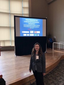
Danielle Bram. Photo courtesy of Sherry Sidick.
CSUN students and faculty have long contributed to California’s efforts to ensure access to clean drinking water, efforts that have intensified during the recent multi-year drought.
A group of students in CSUN’s Center for Geospatial Science and Technology (CGST) is helping in these efforts. The CGST, which is part of the College of Social and Behavioral Sciences, is working with other CSU campuses on a project that uses mapping technology to identify and prioritize communities in Southern California that are in need of sufficient water and help with other water management-related resources.
CSUN and its partners discussed the project on May 9, the CGST hosted a Water Resources and Underserved Communities Symposium at the University Student Union Grand Salon. Other participating campuses included CSU San Bernardino, Cal Poly Pomona and UCLA.
In California, hundreds of thousands of people in disadvantaged communities go without clean drinking water and are often overlooked when it comes to other crucial areas of water management. These populations include the homeless, migrant and residential farmworkers, Native Americans on reservations, those in economically distressed areas and anyone who doesn’t have regular access to clean drinking water. Management and supply of water in the state is the purview of the California Department of Water Resources, California Water Resources Control Board and the Bureau of Reclamation, among others.
Water management includes gauging surface and groundwater quantity and quality, planning flood and stormwater management, preparing drought contingencies and other emergency planning.
“Communities most impacted by water management issues face many barriers to engagement in addressing those issues,” said Danielle Bram, director of CSUN’s CGST. “The linkage in connecting the community to the creation of new water-related projects is critical. If a community has little or no awareness of water management issues, they are not likely to adequately respond to outreach and engagement efforts to help address them and advocate for their community.”
Since 2015, CSUN has participated in a CSU program called the Water Resources and Policy Initiatives (WRPI). The WRPI, based out of CSU San Bernardino, develops water management solutions through research, partnerships, education and training that provide students with hands-on learning.
CGST and WRPI utilize Geographic Information Systems (GIS) for their work. A geographic information system (GIS) is a system that uses databases and tools to create, store, manage and analyze spatial information. Students can use GIS to better identify where the underserved and disadvantaged are across the state and how to identify them, in order to prioritize who has the most pressing needs.
GIS gathers data including socioeconomic data from the Census Bureau, county and water agency boundaries, and street network data. GIS then links that data to specific locations — for example, highlighting concentrations of households with low incomes — and shows where water is located in relation to those communities.
“Layman’s definition: Almost everything that happens on Earth has a location,” Bram said. “Where we work, live, events … all these things can be mapped and analyzed.”
Five CSUN students, both graduate and undergraduate students, are currently working on the project. One of the students involved, Fernando Romero Galvan, was brought on to assist with programming and automating the processing of data into GIS.
“I believe the implications of this are beyond what I ever imagined myself doing, I consider it work that will help many people that would otherwise overlooked,” Romero Galvan said. “Additionally, as a student, the opportunity to work on this project has helped me make decisions in regards to what is next for me professionally and academically, I would like to become the kind of person who could help in the effort of trying to resolve these type of problems or at the very least, be able to model them.”
CGST is also working to identify surface water features throughout California, Bram said.